St. Andrews UHI experiment, February 25, 2008

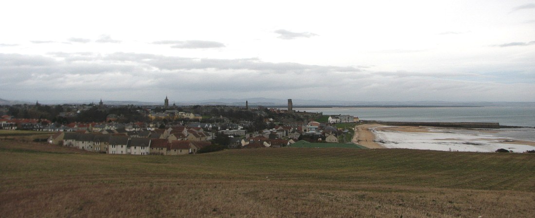
St. Andrews seen from southeast February 25, 2008 10:43 AM.
The general weather
situation, measurement equipment and measurement route
The weather was dry and overcast, with a warm front approaching from west. The wind was strong from SSW, about 14-16 m/s. The ambient air temperature was about 6.5oC.
A thermistor mounted inside a
radiation shield was attached to the roof of a car (c. 1.5 m above terrain), and
temperatures were logged at 2 sec. intervals. The time given in the diagrams
below is according to normal winter zonal time. The measurements were carried
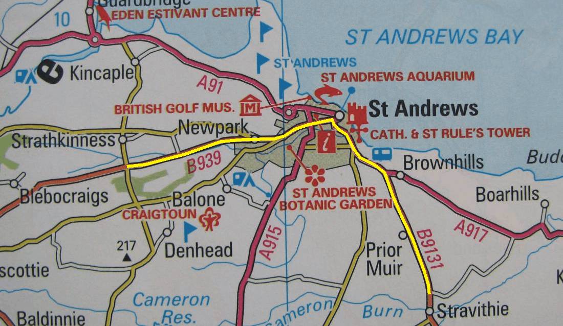
out for a route passing through the city from west to southeast, as shown by
the map below.
St. Andrews
is located at 56o20'N
2o50'W, on the east coast of

Map showing location of the measurement route (yellow). The map measures
12 km from west to east. The altitude ranges from 5 to 60 m
asl., highest at the endpoints of the traverse.
Results

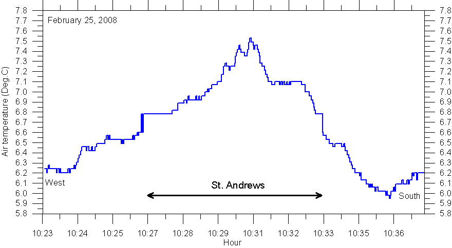
Result
of temperature traverse 25 February 2008: Starting in rural landscape west of
Interpretation
According
to conventional wisdom the UHI effect should disappear as wind speeds goes up,
mixing the lowermost part of the atmosphere more efficiently. However, the above
graph shows that this is not always the case. The interpretation is that the
strong SSW winds (14-16 m/s) introduced a forced ventilation of the heated
buildings, whereby enough warm air escaped to the exterior to sustain a clear UHI
effect in St. Andrews.