St. Andrews UHI experiment, May 6, 2008

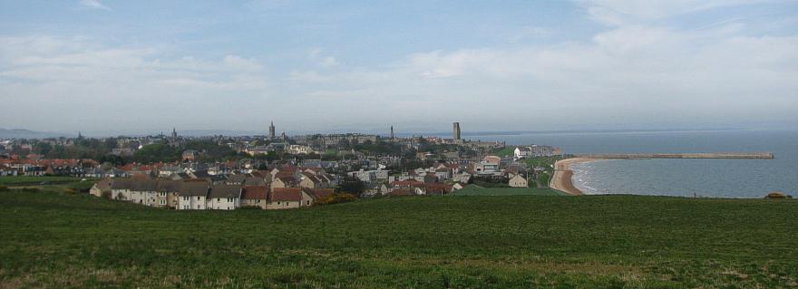
St. Andrews seen from southeast May 6, 2008 hr.12:59.
The general weather
situation, measurement equipment and measurement route
The weather was dry and partly overcast, with a high pressure spreading from NE across the North Sea. The wind was moderate from E, about 4-6 m/s. The ambient air temperature was about 15oC.
A thermistor mounted inside a
radiation shield was attached to the roof of a car (c. 1.5 m above terrain), and
temperatures were logged at 2 sec. intervals. The time given in the diagrams
below and in the figure caption above is according to solar time (not corrected
for summer time). The measurements were carried
out for a route passing through the city from west to southeast, as shown by
the map below.
St. Andrews
is located at 56o20'N
2o50'W, on the east coast of
![]()
Map showing location of the measurement route (yellow). The map measures
12 km from west to east. The altitude ranges from 5 to 60 m
asl., highest at the endpoints of the traverse.
Results

Result
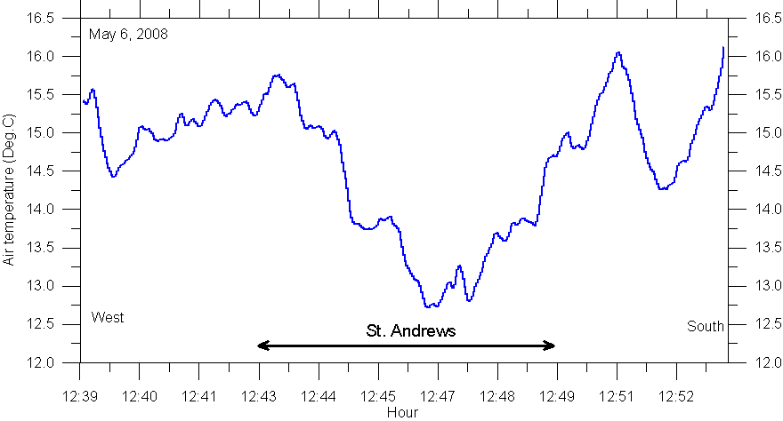
of temperature traverse May 6, 2008: Starting in rural landscape west of
Interpretation
In western St. Andrews the onset of a urban heat island is suggested by the temperature reading, but a short distance further east this effect disappears, and relatively cold air masses moving onshore from the nearby North Sea dominates the temperature. In easternmost St. Andrews, near the coast, the recorded air temperature is about 12.8oC, while further inland the temperature is 15.5-16.0oC. The ocean cooling effect at the time of measurement was about 3oC.