St. Andrews UHI experiment, June 11, 2008
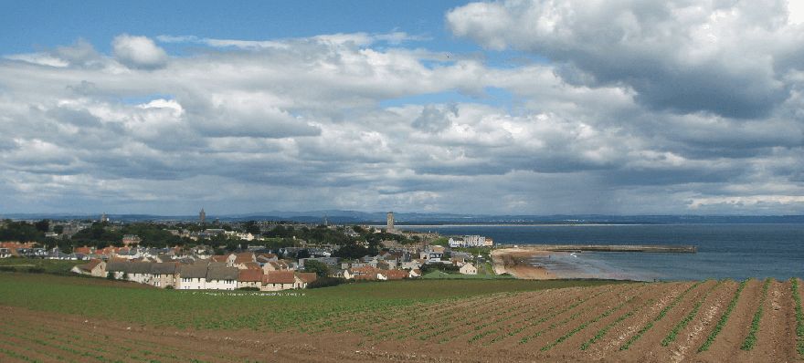
St. Andrews seen from southeast June 11, 2008 hr.10:40.
The general weather
situation, measurement equipment and measurement route
The weather was dry and partly overcast, with somewhat moister air moving in from NW (see photo above). The wind was moderate from NW, about 4-6 m/s. The ambient air temperature was about 17oC. Because of the moving clouds, areas with cloud-induced shaddow were moving across the landscape in a south-easterly direction.
A thermistor mounted inside a
radiation shield was attached to the roof of a car (c. 1.5 m above terrain), and
temperatures were logged at 2 sec. intervals. The time given in the diagrams
below and in the figure caption above is according to solar time (not corrected
for summer time). The measurements were carried
out for a route passing through the city from west to southeast, as shown by
the map below.
St. Andrews
is located at 56o20'N
2o50'W, on the east coast of
![]()
Map showing location of the measurement route (yellow). The map measures
12 km from west to east. The altitude ranges from 5 to 60 m
asl., highest at the endpoints of the traverse.
Results
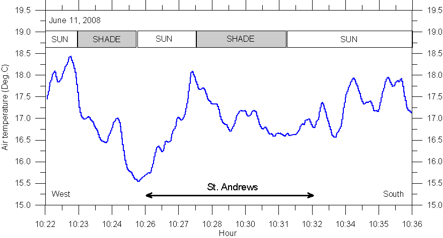
Result
of temperature traverse June 11, 2008: Starting in rural landscape west of
Interpretation
The temperature pattern recorded is dominated by local heating effects, controlled by changing conditions from sunlit to being in cloud shaddow. In western St. Andrews the onset of a urban heat island may weakly be suggested, but it is not possible to discriminate from sunlit-shaddow effects. The airflow was from NW, and there is therefore no local effect of the ocean, as was registered on May 6, 2008. The thermistor was positioned about 1.5 m above terrain, and the results suggests that shifting conditions between sunlit and shadow rapidly are felt several metres about the ground. Standard meteorological measurement height is 2 m.